|
Welcome to Skyepony's Weather Blog.
|


|
2022 has come and gone and what a wild year for weather. Here are my best pictures, gifs and memes for the year. 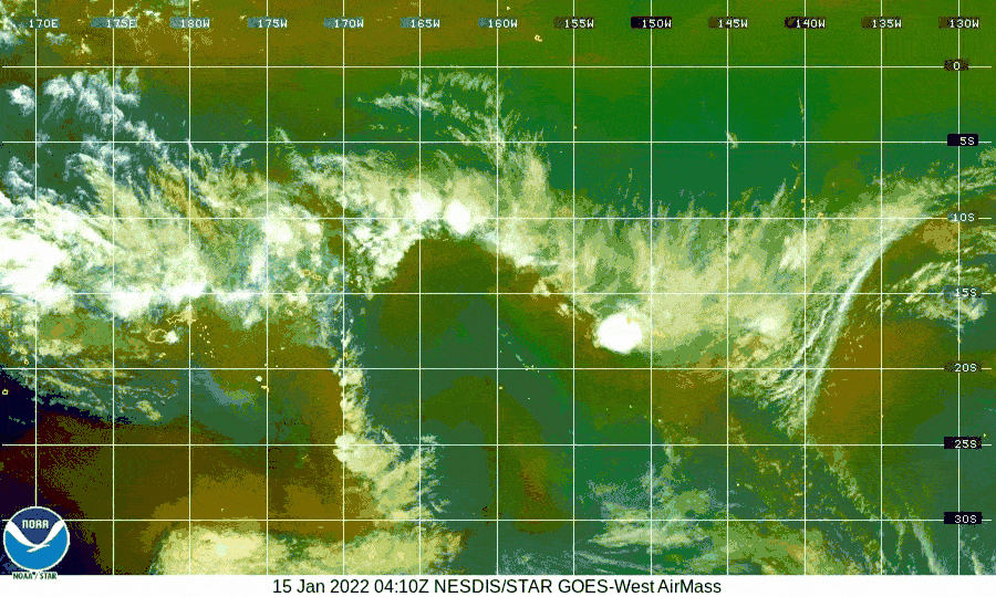 1/15 Tonga Volcano 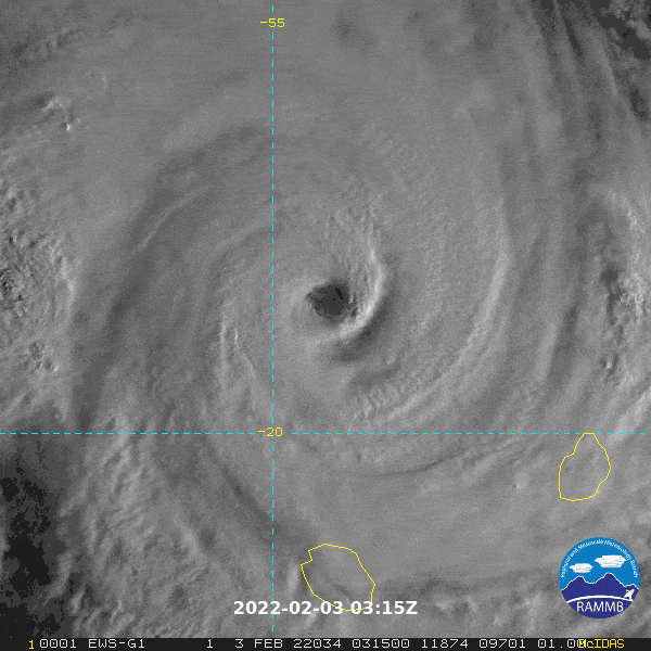 02/03 Batsirai 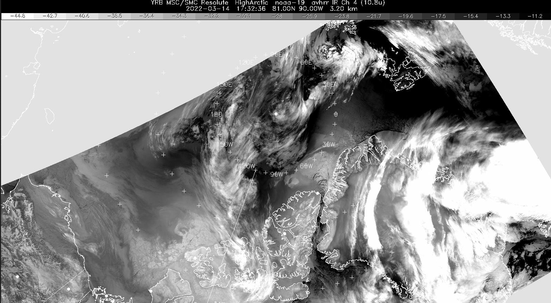 03/14 Lack of Ice in the Arctic. A string of lows kept coming up Greenland and wiping out the ice. Another one coming is captured here to the east of Greenland. 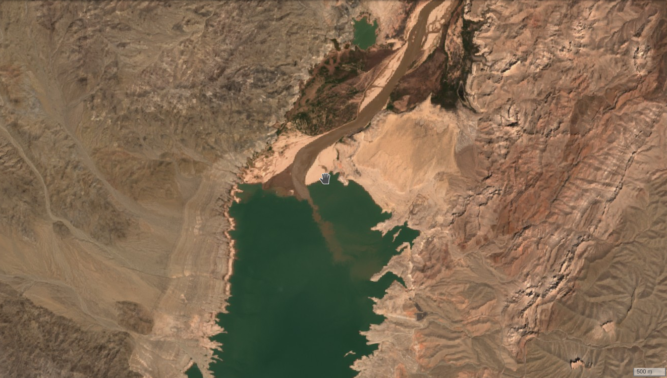 04/27 April brought the watch to a Bahama Blob, tornadoes and drought. Pictured is much shrunken Lake Mead. By the end of the year Youtubers documenting the lake shrinking would be banned from using footage from the lake without a permit.
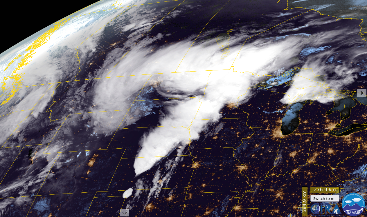
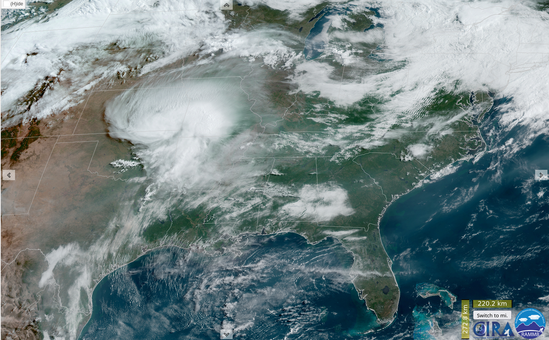
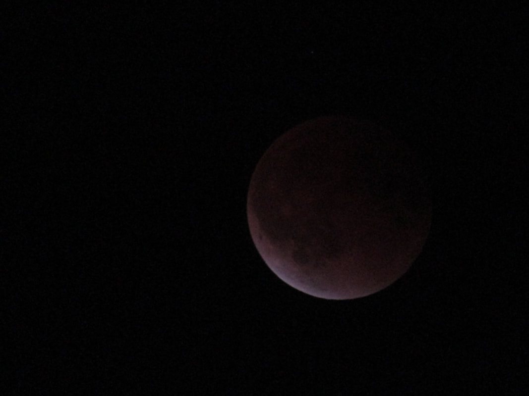
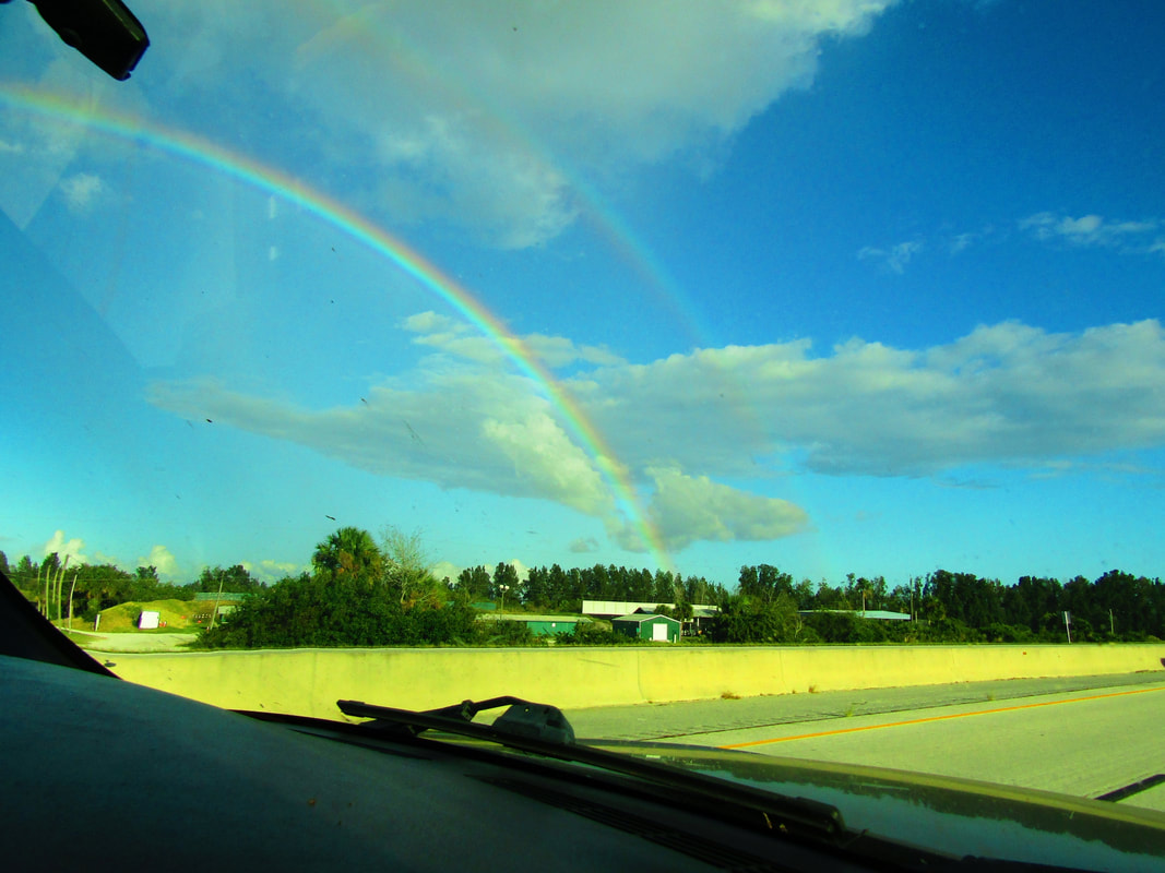
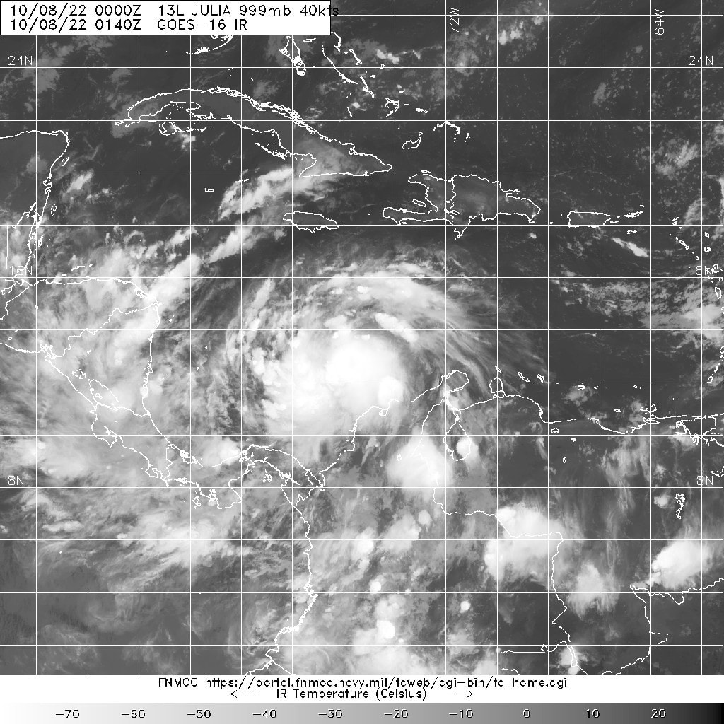
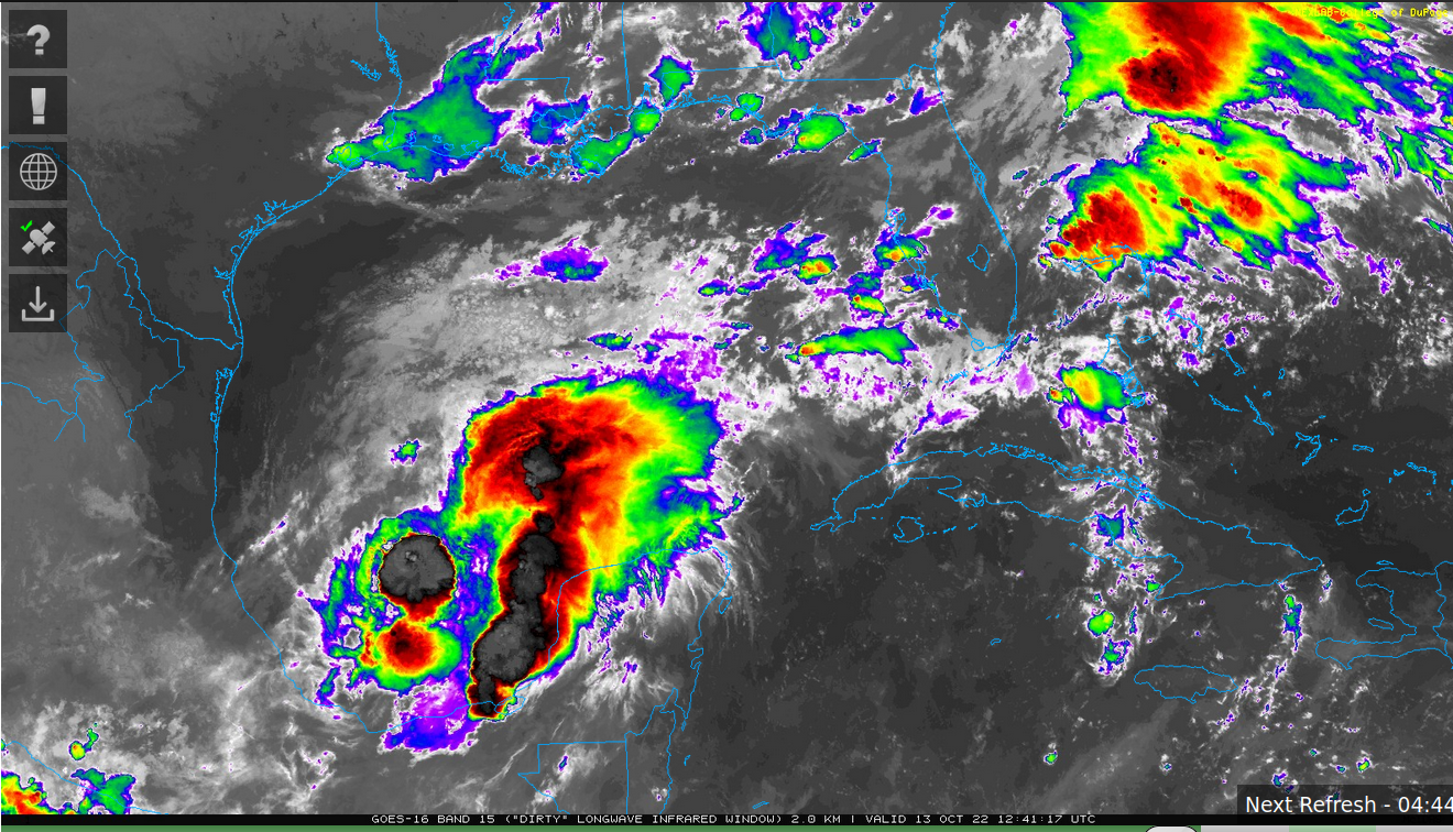
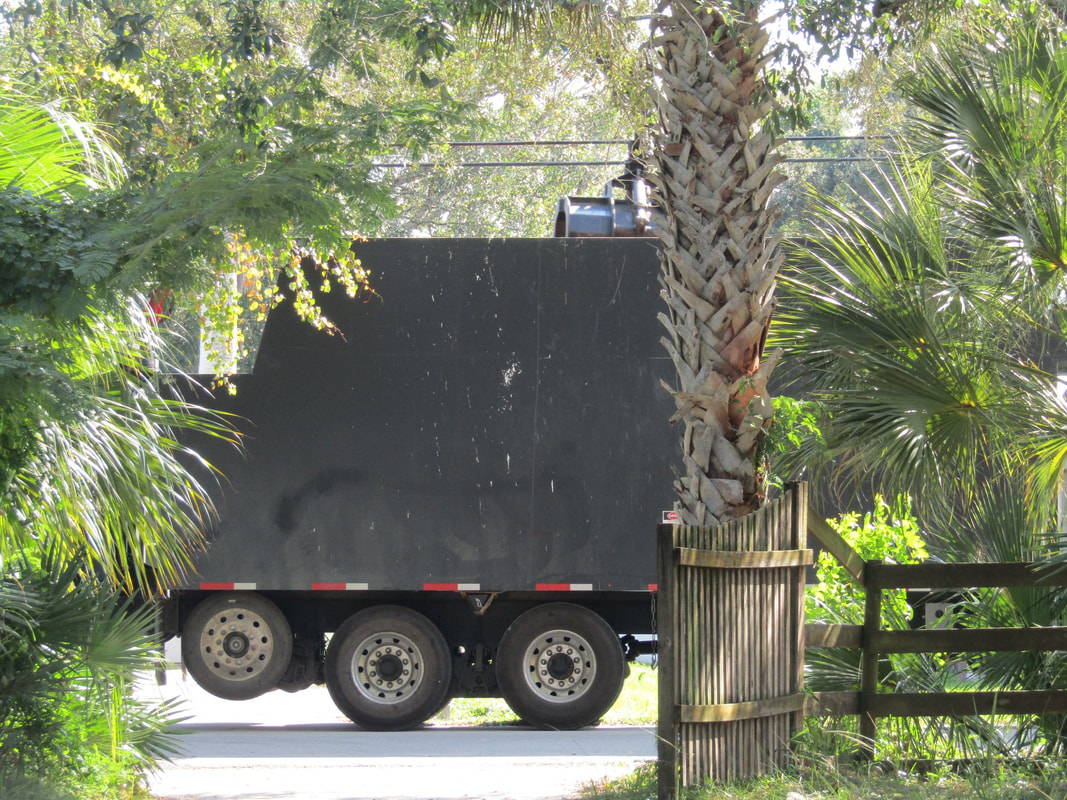
May brought some landcanes. These are from 5/13 and 5/19. The end of the month brought an eclipsed moon. June had a lot of blob watching, some invests, several heat related memes and a pumpkin. In July the slow hurricane season was trumped by the continued systems bringing excessive rainfall across the middle of the United States. This came to a head at the end of the month with a Great Flood in Eastern Kentucky. Windorabug happened to be schooling there and captured these pictures. 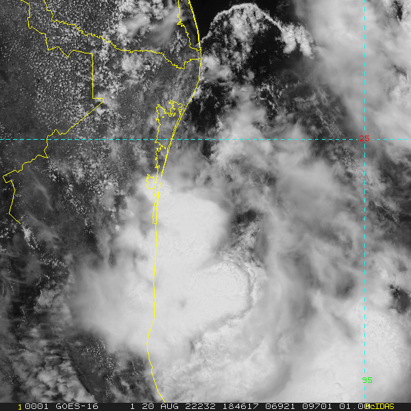 August was mostly invest watching. There was few storms worldwide. The Atlantic managed to produce 04L, seen here moving into Mexico. During September the Atlantic hurricanes came to life. Pictured is Danielle, Earl, Fiona and Ian. October started with the shock of Ian damage. Pictured is the Ft Myers Hooters after the surge rolled through, a rainbow in Cocoa, FL 10/22, Julia 10/08 0140z, Karl 1013 1214z and a FEMA truck. November rapped up hurricane season. Pictured above is Lisa and Nicole. Nicole was a direct hit here in Melbourne, FL. Still rebuilding fences.  December had 99L, rain for the West Coast and a deadly holiday blizzard. Best wishes for 2023 everyone!
Comments
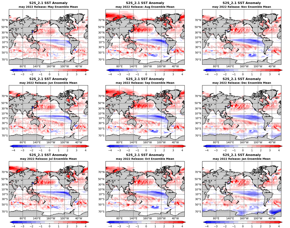 Looking at precipitation to come there is little good news for the drought in the Western Unites States. While the East Coast and Gulf of Mexico maybe in for some storms. 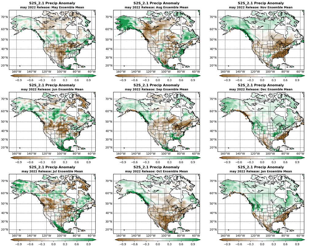 Globally India may see 5 more months of flooding. Equatorial and Central America should see a few more months of above average rainfall. Caribbean isn't looking as dry as it has been. 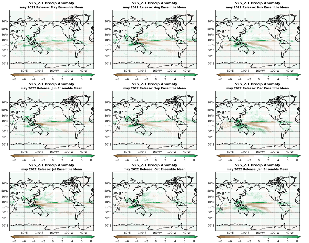 Can't look at summer without a glance at Atmospheric Temperature anomalies at the height of 2 meters above ground. For North America, the forecast is for a mostly warm spell ahead. 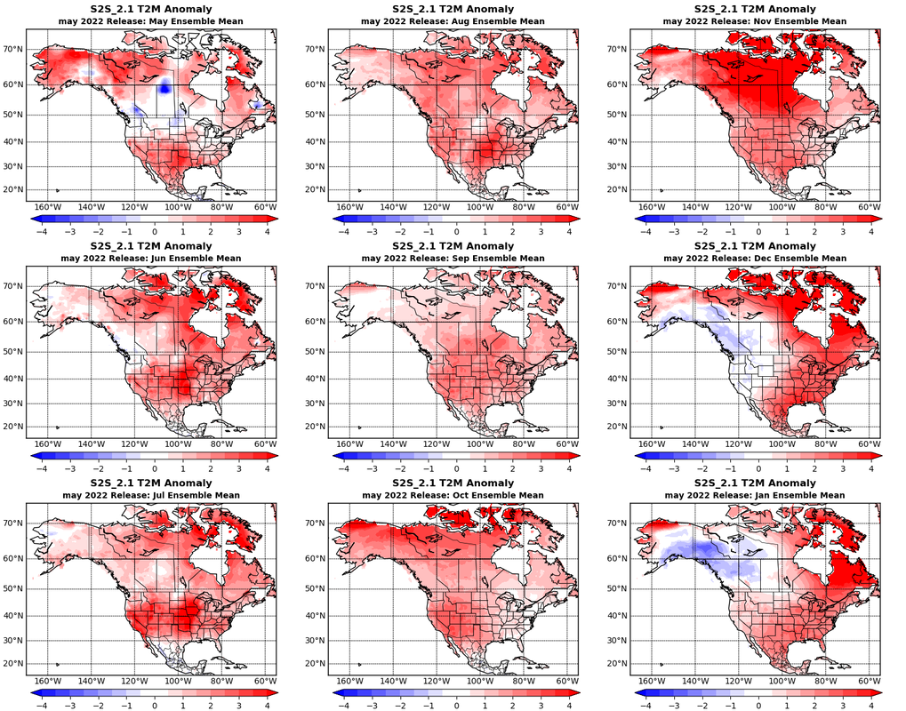 Globally the temperatures shift extreme with the seasons. Summer may bring extreme heat by fall to the Northern Hemisphere as the Southern Hemisphere shows some cooling over it's winter. The Antarctic sea ice may get a boost in areas from the heat on land. 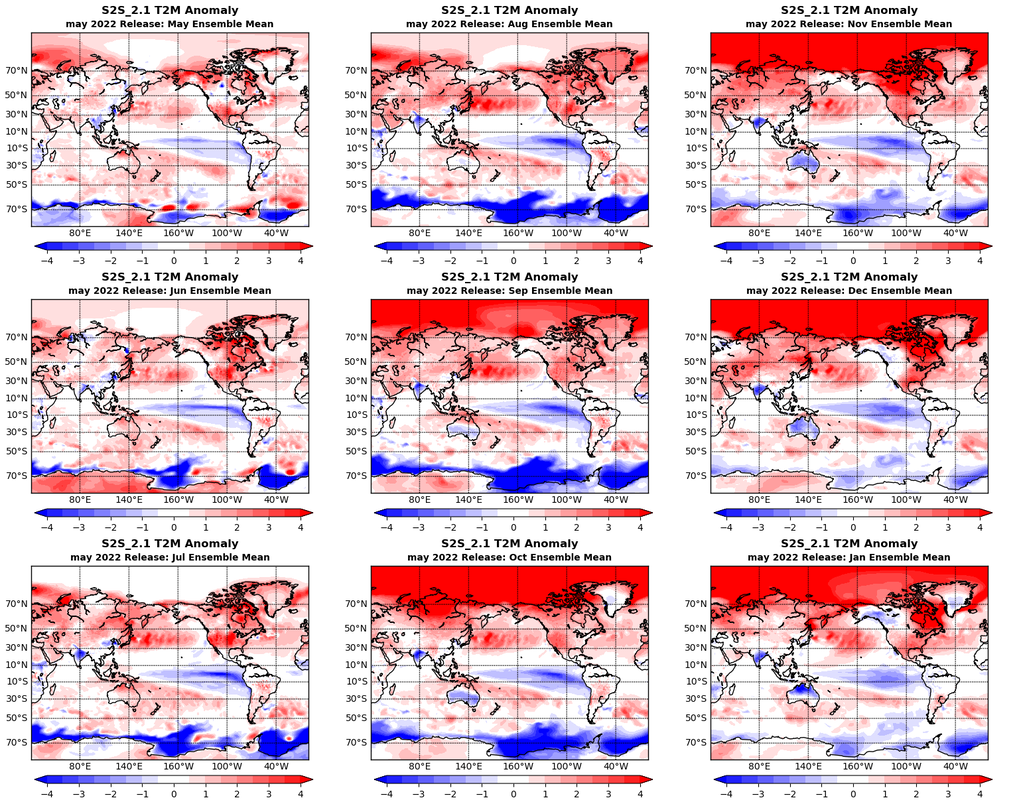 Sea Ice for September, the Arctic looks pitiful with such a shrunken area of sea ice with none of it even more than 90% solid.  Seems as good as any year to prepare early, for the worst, while hoping for the best. Florida's Annual Disaster Preparedness Holiday is from May 28-June 10, 2022.
Been way overdue to write a blog or even get back to writing. Took an excessive bunch of pictures of the Hunger/Snow/Wolf Moon and a Falcon 9 launch. It seemed time to blog again. The moon rise last night was stellar with it coming up yellow. It had been a day of more sirens wailing in the distance and less goods on the store shelves. It all washed from thought with the sight of the moon peaking over the trees as I readied the herd for a cold night. This being the first moon after winter solstice, is the Hunger Moon. Also known as the Wolf Moon (from the howls of hungry wolves) or for many of you, the Snow Moon. The moon was most full January 17th at 2348z. Note the high path in the sky this month. January's moon follows the Sun's summer path six months from now. Venus and Mercury are both in retrograde. Horoscope wise this could make for a tiring time, still processing last year and wallering in emotions from it all. The full moon tends to amplify those emotions, inklings and intuitions, especially those that have been neglected. It's a good time to recognize, reckon and create those conclusions. Find peace to move on. It can be a little dramatic at times but needed to tackle the year ahead. It's a Cancer full moon (emotional), oppositional to Pluto (death, regeneration, underworld). Sort of moon to drag out emotions, struggles, obsessive thoughts while putting an end to bonds and cycles that aren't working. Moon is also close with Neptune and Pisces, making it all not so bad. Creative, spiritual and romantic energies are abound to possibly expend the pent emotions in positive ways. 3, 2, 1 LAUNCH! Tonight a Falcon 9 launched from Kennedy Space Center to deploy another bunch of Starlink Satellites. The launch was to the Southeast and passed above the full moon. To capture both in the same frame was a rarity. This launch went off first try tonight after being delayed twice. Happy New Year Everyone!
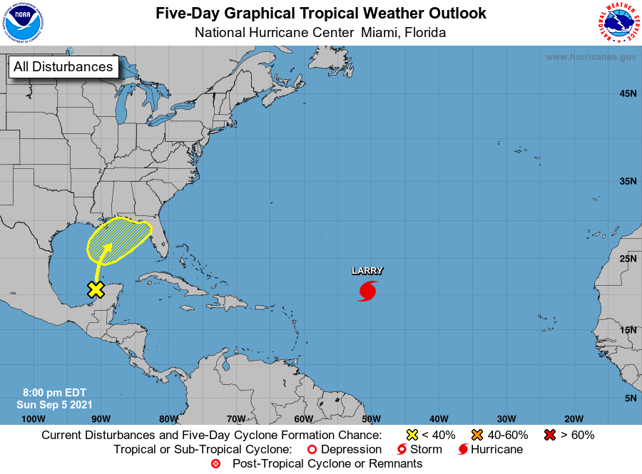
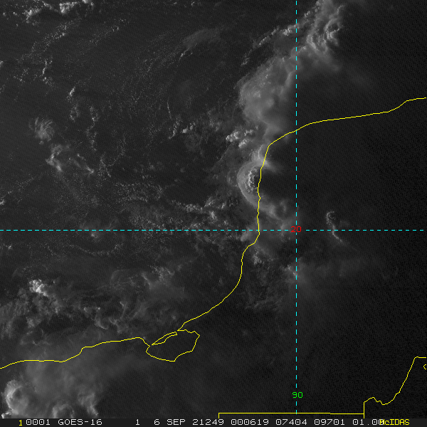
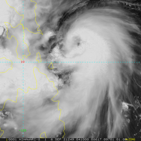
Atlantic 91L.INVEST currently has a wind speed of 20kts. It is disorganized after being over land. Models are split about development. It looks like the energy should be swept up in the tail of the front that turns Larry away from the Unites States. It may or may not develop before land fall in the Northeast Gulf of Mexico. and after it exits from or near Georgia. 12L.LARRY looks to be near peak. It has a pressure of 955mb and a wind speed of 110kts. Larry has become annular with a best score of AHI#45. Bermuda and far East Canada should continue tracking this storm.
Look out for the crafty ponies out there..  With September 1st comes Meteorological Fall. But first a local look back at the summer that went too fast and reproduced too much covid. Heat wise Eastern Central Florida was in the top ten hottest summers since record keeping began. As for rain, most cities were a few inches under or over average.  Larry Larry formed from 90L off the coast of Africa August 31st and has steadily intensified since. Currently NOAA ADT has it at 981mb and 79kts. All along it has been forecast by most models to be a monster of a storm. Early on they all went out to sea. The storm, recently declared a hurricane, has stayed embedded in the Inter-Tropical Convergence Zone (ITCZ) and has trucked west. The models are beginning to show concern for Bermuda, the latest runs show some west of that even. 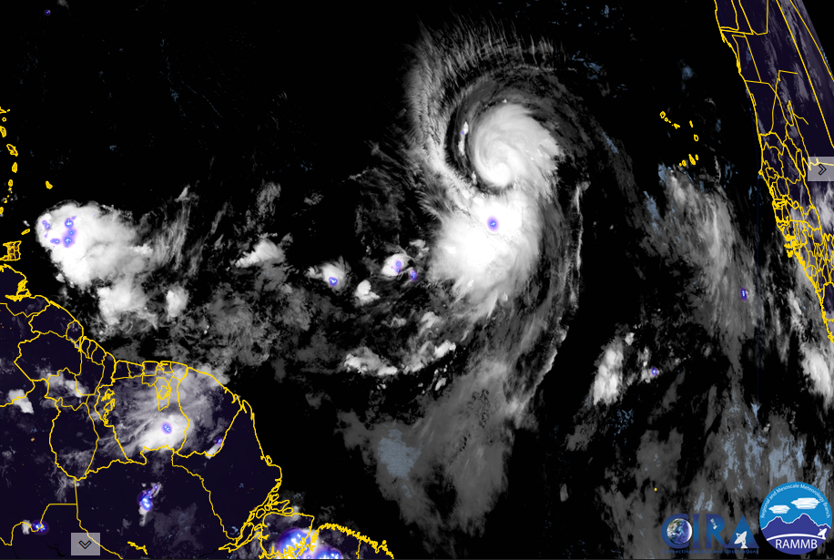 Hurricane Larry is center, 92L is just off Africa. 91L has run into Central America. A few models have it coming to life in the Caribbean again. Ida's coastal damage imagery is here. According to NOAA ADT Ida made it back to the Atlantic Ocean about 8hrs before becoming post-tropical. It also spent a little more than 1/2 of it's life over land. 17W was declared in the Western Pacific yesterday. It is not expected to strengthen much. 94W is new. Looks gamely and is pictured below. 
Hurricane Ida came off Cuba looking hardly effected by it. Oil interests are taking action in the Gulf of Mexico cutting 1.6million barrels of oil, evacuating 90 offshore facilities, as refiners cut production. The Gulf currently supplies 17% of the nations oil production. Ida is expected to have a greater impact on oil production than Hurricane Katrina did. Surge forecast has high water for pretty much all of the Gulf of Mexico . Waveland, MS is forecast for over 5ft of surge and Grand Isle, LA for over 6 ft. The highest surge is expected to be near twice that.
Mayor LaToya Cantrell said that New Orleans did not have enough time to evacuate completely so it was deemed voluntary and encouraged residence to ride out the storm. More on evacuations here. and here Refresh page to update these model graphics from Emanuel at MIT    Surface Map  NORA in the Eastern Pacific is expected to move north along the western coast of Mexico.  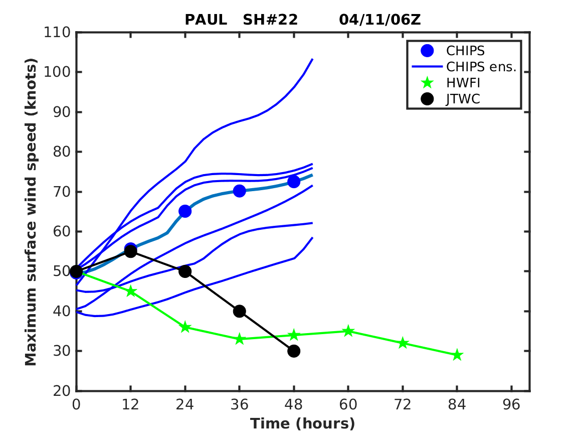  Ida Photo Gallery
Live from the Cats Meow Balcony in New Orleans.
Fred has had his final advisory issued after 11 days. Just over half of the life of this storm was over sea. Fred was a real land lover. Affected some islands in the Lesser Antilles and then Puerto Rico. He started wrecking homes in Hispaniola. From there it was Cuba and then a turn to the north for the Florida Panhandle where the rain and effects were felt all the way to Maine, with Western North Carolina getting wrecked with floods and tornadoes hitting Upstate, South Carolina. Fred's highest winds were 65mph, lowest pressure was 993mb. At least 3 people died and 20 people are still missing. Grace is headed for Mexico. See NHC Key Messages below. According to ADT she hit the Yucatan with a pressure of 976.4mb and a wind speed of 79.6kt and was knocked down to 49kts after crossing it. The flags are now off as Grace begins to intensify again. Henri ~ Everyone is watching this one to begin it's turn to the north. Recon gathered upper air data this evening so models should agree better on this storm by morning. See Key Messages from NHC below. Reed Timmer in Balsam Grove, NC This is an area I know well. In the opening scene he is at Living Waters on 215. I've posted pictures of this place over the years, a house over looking the waterfalls where North Fork French Broad meets Shoal Creek. In the scene from left to right is a car pinned against the side of the river, waterfall on North Fork French Broad, waterfall from Shoal Creek dropping in and the barn structure attached to the back/bottom of the house.
Tropics are starting to come back to life. In the Eastern Pacific there is a line of three storms. From left to right is 09E, Hilda & the most recently declared 10E. 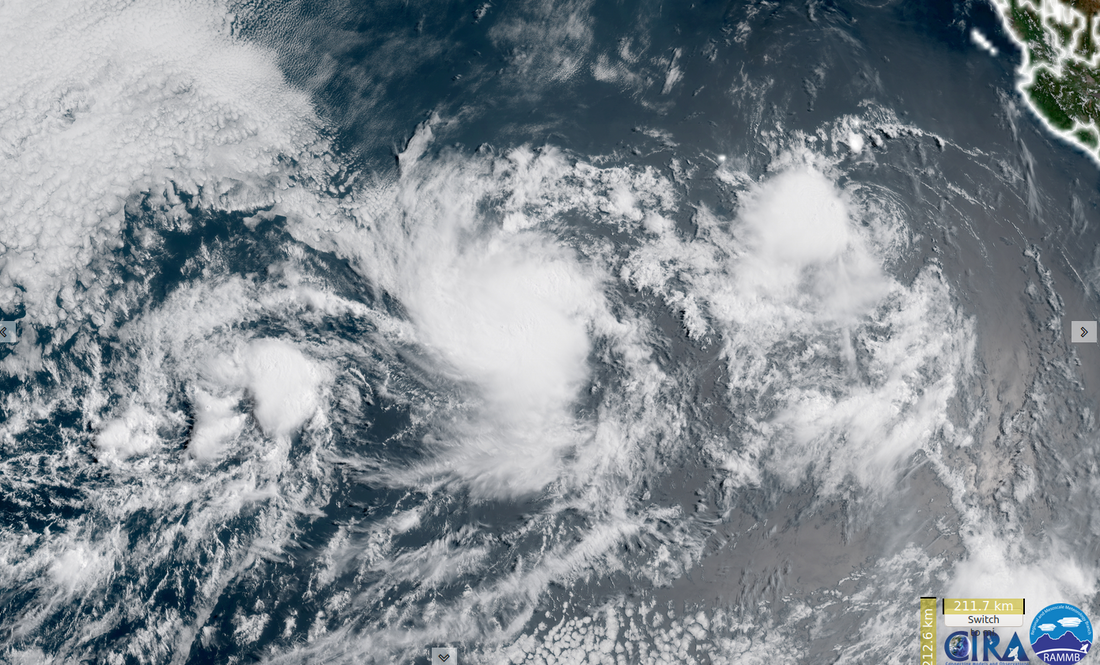
Atlantic has some areas to watch. There is a tiny swirl east of Florida, shear has whisked away it's convection. Might see a Central American Gyre get going. Most the models have that causing another storm in the EPAC, with it traveling along various parts of the coast. Slim chance that happens in the Western Caribbean. Also there is a big blob off Africa that wants to develop into a low but is so large it will be difficult to organize. MJO is coming for this basin. Watching Greenland Melt This Little Whirlwind is Spinning Backwards Lookout for the extreme heat.
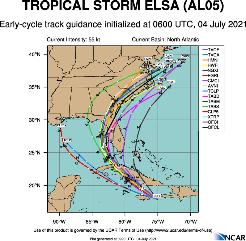
White Rabbits X 3 and Happy August Everyone! Elsa brushed Haiti and Jamaica. The waves were notable. Crossed Cuba with 60mph winds and heavy rain. Elsa was disrupted by the crossing enough the effect in The Keys was overall windy. 70MPH was the highest recorded, on Key West at the airport. 63MPH winds were reported from Sand Key. RV campers mostly stayed. There was wind, rain and some waves. Tampa Area impact: Once to Florida, Longboat Key had winds to 60mph, Bradenton to 54mph, Clearwater Beach 59mph. SR64 and the Rail Road tracks are closed in Wachula from flooding. North Port and Cape Coral also have multiple roads closed due to flooding. Brandon and Carolwood area saw multiple trees come down. North Florida: 1 fatality occurred from a tree falling on two cars on Roosevelt Blvd in Jacksonville. A tornado was also spotted on radar and media there. PRIVATE PROPERTY DAMAGE NEAR PHILLIPS HIGHWAY AND BOWDEN ROAD occured. THERE WAS ALSO COMMERCIAL PARK AND PRIVATE PROPERTY DAMAGE ON POWERS AVENUE AND BOWENDALE AVENUE. A radar indicated tornado was spotted in Camron, GA NEAR HEAVILY DAMAGED RV PARK NEAR KINGSBAY NAVAL SUBMARINE BASE. Trees came down and power was lost in some parts of Duval County. 45mph winds were reported in Brunswick, GA. 58mph winds were measured in Glynn, GA Slideshow of Elsa from near Haiti to Georgia. 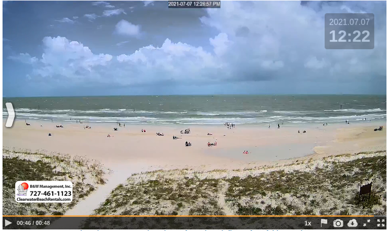 The storm surge at Clearwater Beach was captured on the beach cam. The overnight hours looked more intense as far as rain and a close lightning flash. The highest water occurred late morning at high tide with a 3ft surge. Made for a nice tide pool for people to enjoy the rest of the day. Simon Brewer does an excellent job capturing the surge in Horse Beach. It covers roads, laps at houses. This area took some damage. Brett Adair / Live Storms Media at Suwannee, FL as Elsa passes through. Texas No Name Storm 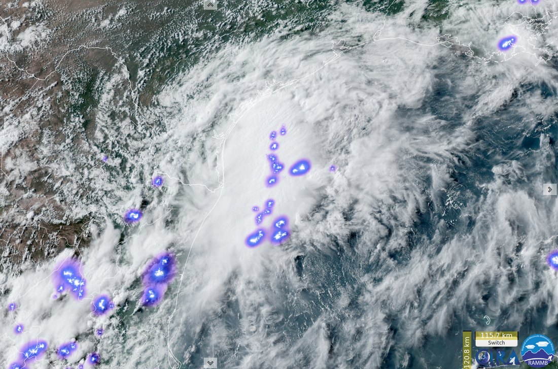 This has been hanging out and pouring on parts of Texas a few days now. Rockport has had some of the deeper water images coming out of there. To see a dump truck that deep in flood.. Stay out of the water. This video has got some beat. CN Post A flash flood emergency is in effect until 4:45 p.m. Wednesday for central Aransas County, which includes the coastal communities of Rockport, Fulton, Copano Village and Key Allegro. According to the National Weather Service, between 3 and 6 inches of rain have fallen in the area over the past few hours and another inch of rain is possible. Flash flooding is already occurring and NWS officials are calling the flooding “a particularly dangerous situation.” Residents are urged to seek higher ground and to be aware of flooding at low-water crossings, small creeks and streams, urban areas, highways, streets and underpasses. In Other Tropics Tropical Depression 8 in the Western Pacific has moved inland, nearly to Laos. It has winds of 30kts with a forward speed of 10kts. It is weakening and expected to dissipate in 36hrs.
Slideshow: Various GOES-East captures from the afternoon of July 1st to the evening of July 3rd. Elsa approached the islands as a named Tropical Storm. It strengthened into a hurricane as it passed over Barbados and then weakened during the day to a strong Tropical Storm before nearing Hispaniola. As soon as the sun went down Elsa began to strengthen again.
Self updating Key Messages from Nation Hurricane Center.

|
Current Tropics and Weather News..
Archives
January 2022
|


 RSS Feed
