|
Welcome to Skyepony's Weather Blog.
|


|
This blog is mostly self updating. Refresh or visit again for latest..
  More info from National Hurricane Center Wunderground Mobile, AL Nexrad Snapshots of Sally
Wundercams From New Orleans to Pensacola
Refresh or visit again for latest. Click links to see videos.
Comments
Paulette and Rene are still both Tropical Storms. Paulette has the better chance to becoming a hurricane and may hit Bermuda on Sunday. It is down to 991mb and has winds of 65kts. Rene has winds of 45kts. 95L is the latest wave off of Africa. There is also two other areas of interest one east and the other west of Florida. The one already in the Gulf of Mexico is expected to move West Southwest. The one east of Florida is expected to move in a general West Northwest direction, this is now 96L. NHC has upped the odds of the one east of Florida to develop to 40% before it moves across the state. Heavy rain is expected in the Bahamas, South Florida and the Florida Keys.
With so many X's around the Southeast and storms in the Atlantic it was time for some self updating graphics.   
Some still pics to document the most active days of Hurricane Season 2020..
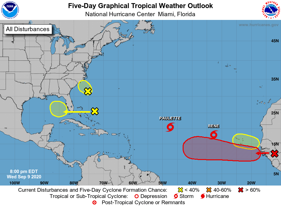 Approaching the height of Hurricane Season 2020 the tropics are active. Though the upper levels aren't too conducive for monster storms and mad divergence aloft there is the edge of a Kelvin Wave passing thru the Main Development Region. Paulette and Rene are both Tropical Storms. Paulette and the red X over Africa have the best chance at becoming hurricanes, Rene could also become a hurricane. As to where these go the models are undecided from run to run and have rarely agreed with each other. With multiple storms so close and other maybe storms trying to form, a higher level of uncertainty of forecast is in play. The red X on Africa probably has the best chance of making it across the Atlantic to landfall. Less likely, Paulette or Rene could curve out and circle back around too. Paulette currently has Bermuda in it's cone. The invest off South Carolina 94L, continues to look less likely to develop. It's recon for the afternoon was cancelled. 94L is running out of time, and is expected to be over Eastern North Carolina by Thursday afternoon. The area that has been over the Bahamas has upped it's odds to develop in the next five days to 20%. It is expected to cross Florida on Friday. 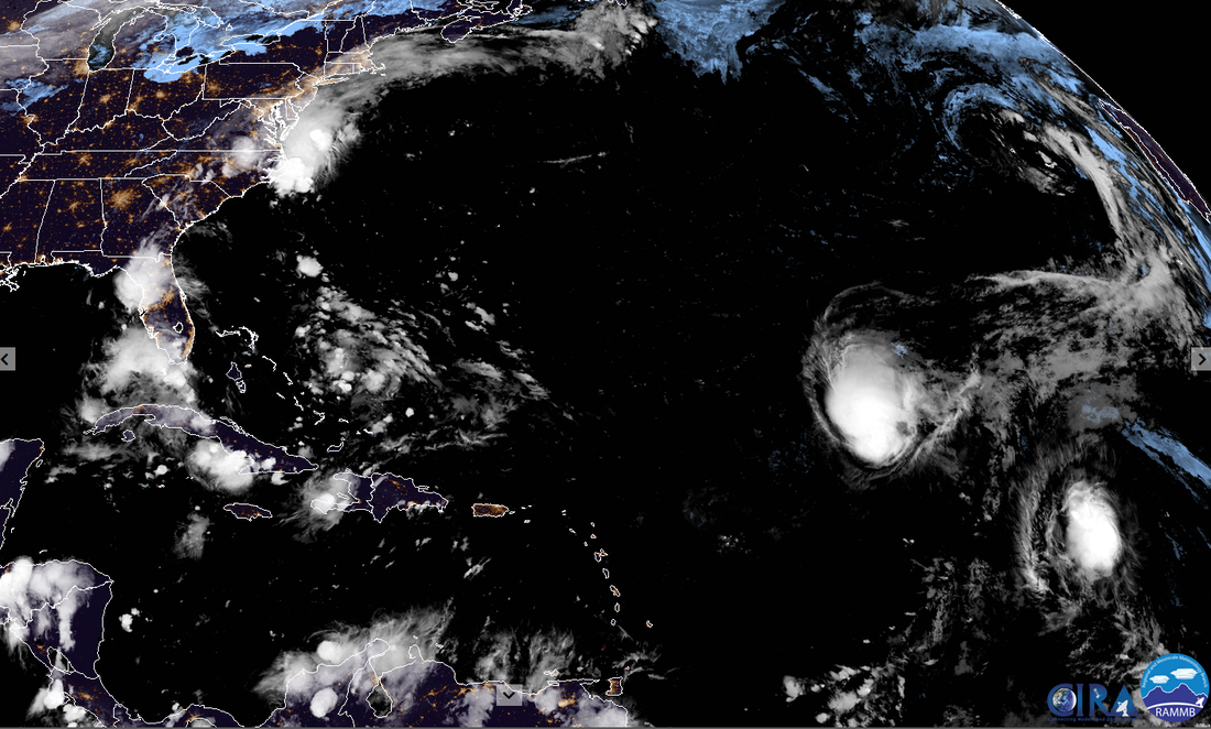 Disaster Days of 2020 Rages On China Flood Surpasses 1998 Tropics
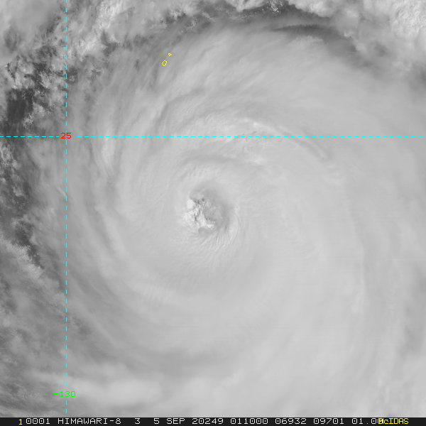
Maysak Damage
A second crewman from the livestock ship that went down in Maysak has been found alive on a raft. The ship stalled and was taken down by a wave with 43 crew and over 5,800 cattle. One crew and a few dozen cattle have been found floating dead. Maysak also killed at least 5 on land by a falling tree, beached crane and windows shattering.
Fuego
Volcan Fuego, located in Guatemala has been erupting again. Below is Aug 30th. Toward the end of the video a meteor can be seen as well. September 1st it sent ash ~15,000Ft into the sky. The live cams have since gone offline around Fuego. It was reported the lava flows ceased on September 3rd.
Globally we've reached that phase where all the Tropical Depressions and invests either matured to Tropical Cyclones or died. We are left with four storms: Nana & Omar in the Atlantic, Maysak & Haishen in the Western Pacific. Three are threatening land. Embedded graphics for those storms below that should update when refreshed.
16L NANA
   10W MAYSAK and 11W HAISHEN      Growing Slide Show of Omar and Nana
Omar was confirmed to still have 35kts by ASCAT and Dvorak CI this evening. The storm is battling heavy shear from the Northeast. It may become a remnant low sometime later on Wednesday. Models have been not at all consistent on this storm. If Omar persists we will most likely see the high come back west, blocking storms from re-curving over the next few weeks.
Check back for more saved images and updates on these storms.
Severe Weather
The day started with flooding reports and rescues in Arkansas and North Carolina. Before the day was over nine tornadoes were reported between Arkansas and Texas. There was an entrapment, barn lost a roof, chicken house and warehouses destroyed. Wind reports came from New Mexico to Tennessee, tore off mobile home roofs, flipped a stock trailer, downed trees and causes power outages. There was also three reports of inch size hail.
Beach Tornado in Italy
|
Current Tropics and Weather News..
Archives
January 2022
|

 RSS Feed
