|
Welcome to Skyepony's Weather Blog.
|


|
High Risk has been issued.. Have not had two High Risks issued in March since 1991. Be safe out there!
If this page has been open a while...refresh for latest.   
Embed current NEXRAD radar from Wunderground. The Radar with Storm Tracks map shows areas of current precipitation as well as storm tracks, top-of-storm elevation, and areas where severe weather warnings or alerts have been issued.
NCAR/RAL Infrared Satellite
03/24-26/2021 Severe Weather Slideshow
Tornado smashes buildings in Vietnam! Madness! Eyewitnesses filmed from a minimum distance!
Comments
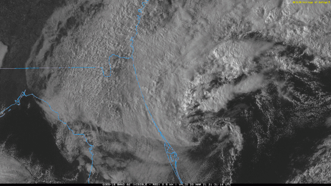 Watching a cold core low trying to form off of Eastern Central Florida. Above is a stagnate gif from 03/20/2021 2201z. The swirl here is not well stacked and is taking some shear but trying. Models are a little torn about if a low really gets going here or much further North-Northeast. It is expected to move away from land. The 248nmi Melbourne radar doesn't look to hold a whole lot of hope of much rain for ECFL. A brief Look at Drought 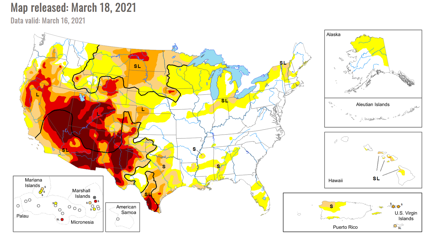 The drought map shows a little improvement this week but much of the drought in the west is looking like it may be around for the long haul in longer range forecasts. Tropics 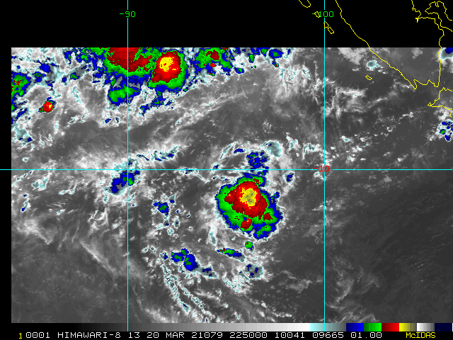 94S is gone. 95S out in the Southern Indian Ocean (pictured above). It is firing back up and moving West-Southwest. 95S has pulled together a little more, balling it's convection up over the last day. The area of strong convection is overall smaller. Taree one of the hardest hit regions in recent NSW flooding emergencySky News Australia
Harrowing scenes are playing out in Taree on the New South Wales mid-north coast with communities under water as a record-breaking downpour dumps enormous amounts of rain on the region. The area is one of the hardest hit so far in the state’s recent flooding emergency. March: A look Ahead NASA's GMAO S2S_2.1 March Anomaly Forecast is out. In the short term the forecast is warmth for the Arctic, Hudson Bay area and into much of North America. Heavy precipitation is expected in Southeastern Asia, Eastern Africa and much of South America. For North America March is warm around the shores of Alaska and cooler in the interior. This extends thru Western Canada into the Western United States. Eastern and Central Canada could see temperature anomalies of 4C or more. These warm anomalies may come with some precipitation. Not much drought relief is expected in the Deep South or Western United States. Long term outlook forecast this month should be taken with a grain of salt. We are up against the spring barrier with ESNO, that time of year when it's more difficult to predict if El Nino, La Nina or neutral conditions are ahead. S2S shows La Nina strengthening from here, which is also a far outlier in the ENSO models this month. Looking at S2S March historical indices and the most recent ESPI available, a continuation of La Nina wouldn't surprise, maybe not as strong as shown in the March forecast though. The trend this model has stuck with, to have a brief summer reprieve from Arctic heat due to La Nina persists. Slideshow 1: 2 meter Temperature Anomalies (red/hot & blue/cold land) for global, global just March, North America & North America just March. Precipitation Anomalies (green/wet & brown/dry) for global, global just March, North America & North America just March. Sea Surface Temperatures (red/hot & blue/cold for oceans) global. Tropics: Habana is a Long Tracker, Niran Hit New Caledonia Started an image collection of Habana. This became a 35kt storm on 03/04/2021 at 1200z. In 24hrs it strengthened to 115kts, then peaked at 125kts 18hrs later. It weakened a bit and has now regained it's eye. Habana is expected to weaken to around 70kts and then strengthen again in 72hrs to 110kts as it leaves and then reenters warmer water. It's expected to be going strong at the end of the 5 day forecast and to not hit any inhabited islands. Slideshow 2: Habana.. The wind uproots trees! Cyclone Niran hits New Caledonia 300 km / h (185 mph) |
Current Tropics and Weather News..
Archives
January 2022
|
 RSS Feed
