|
Welcome to Skyepony's Weather Blog.
|


|
Globally we've reached that phase where all the Tropical Depressions and invests either matured to Tropical Cyclones or died. We are left with four storms: Nana & Omar in the Atlantic, Maysak & Haishen in the Western Pacific. Three are threatening land. Embedded graphics for those storms below that should update when refreshed.
16L NANA
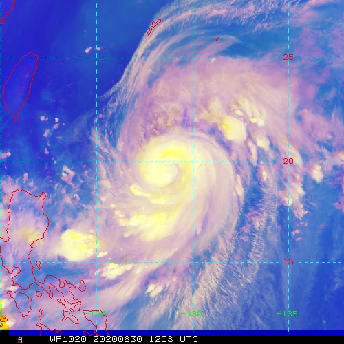
   10W MAYSAK and 11W HAISHEN      Growing Slide Show of Omar and Nana
Omar was confirmed to still have 35kts by ASCAT and Dvorak CI this evening. The storm is battling heavy shear from the Northeast. It may become a remnant low sometime later on Wednesday. Models have been not at all consistent on this storm. If Omar persists we will most likely see the high come back west, blocking storms from re-curving over the next few weeks.
Check back for more saved images and updates on these storms.
Severe Weather
The day started with flooding reports and rescues in Arkansas and North Carolina. Before the day was over nine tornadoes were reported between Arkansas and Texas. There was an entrapment, barn lost a roof, chicken house and warehouses destroyed. Wind reports came from New Mexico to Tennessee, tore off mobile home roofs, flipped a stock trailer, downed trees and causes power outages. There was also three reports of inch size hail.
Beach Tornado in Italy
Comments
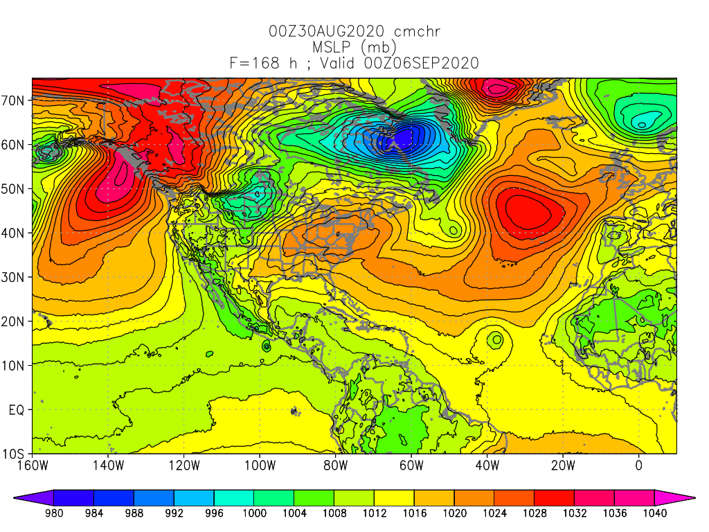
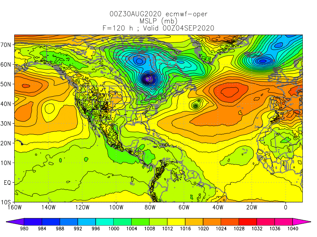
99L and 90L 99L was declared first and has just entered the Eastern Caribbean. It is developing from a wave that had been building convection in the Main Development Region. CMC was the only model developing this much at first and took it into Central America and the Eastern Pacific where the CMC and other models develop it into a storm. It looks more gamely than models predict so the forecast for this is pretty uncertain. Another area of interest is over Northeast Florida is now moved offshore and has been designated as 90L. That is expected to become a storm off North Carolina the afternoon of September1st. The ECMWF has this storm run into and take a smaller satellite low around it and absorb it. Either way this moves East-Northeast across the Northern Atlantic, the larger effect plays out on the Atlantic High as a third area of interest that is coming off Africa develops. These two storms move across the Atlantic in opposite directions possibly pumping the ridge from the bottom and top back toward the Western Atlantic and United States, preventing the southern storm from re-curving out to sea. Global Tropics
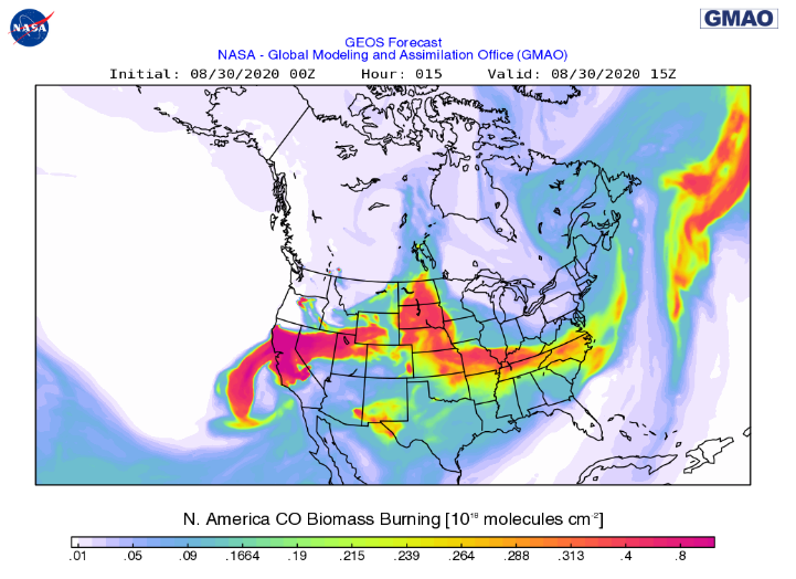
September Look Ahead September 2020 overall is expected to be a hot month for the Earth with a few cool pockets left around the Antarctic and Eastern Pacific as La Nina intensifies. The expected well above average heat in the Arctic for this coming Fall should really begin to set in. As a sign to the interesting times ahead Siberia just had a new hydrolaccoliths open up, #17 and it's by far largest one yet, since they first appeared in 2014. These are giant holes or funnels that open up from permafrost melting and methane gas accumulating underground. The gas gathers in a large bubble, deforming the earth into a mound called a pingos until it explodes/gives way to a giant hrydrolaccoliths. This one was much larger and had new findings that haven't been announced yet as they study the data and plan to release scientific papers. Major concern is being noted that from satellite and helicopter inspections many pingos have been spotted, some literally holding up fuel pipelines. This is the last month above average rain is expected over the Mississippi Valley and Mid-west for a while. Florida and the Mid-Atlantic coastal regions can expect above average rainfall as well with the continued hyper active Hurricane season in process. Central America can expect more devastating flooding as storms generally gravitate more west with La Nina setting in. Globally the southern area of Southeast Asia and the wave train across Africa are also expected to take some of the heavier flooding. India is still expected to have above average rain but it is a little less than August. The fires out west have added smoke to watch this coming month as well. In the coming week the smoke plume drug across the United States by Laura should work it's way back to thicker smoke along the West Coast. Best of September to everyone. Arctic Sea Ice is close to a new minimum but probably won't break the record. North America and the Caribbean have taken above average storm damage so far this year and will likely take more, while corona is still wrecking havoc on lives and populations. Look out for each other, stay well and prepared. This too shall pass.. |
Current Tropics and Weather News..
Archives
January 2022
|

 RSS Feed
