|
Welcome to Skyepony's Weather Blog.
|


|
Tropical Storm Danny came from a broad low that slowly tightened as it drifted west the last few days. It was declared a depression this morning and then a Tropical Storm at a Special update at 3pm. Recon just found winds of 40mph and higher gusts. A gust report of 41mph has been reported on Folly Beach. It looks to be moving toward Beaufort and Hilton Head area of South Carolina. Storm surge of 1-3ft is expected from Port Royal Sound to South Santee River.
Begin Self Updating Graphics
  End Self Updating Graphics 96L's Transformation into Danny
Osprey live cam in Savannah. They ate what looked like a fish about 8hrs ago. The mostly grown baby hung around a while, complained at the camera some. Once the rain started flew off, probably for better cover. Hear them off in the distance. They are close.
Comments
Claudette has been a dread all along to some. Predicted for weeks on the GFS model. That foreshadowed an ever changing story of the Central American Gyre pulling together to then move north, bringing anything from flooding to a well developed storm from Texas to Georgia. It brought that dread to some of season is here. Already some neighbors have partially boarded their homes in Central Florida, feeling safer just in case it happened to veer off the forecast path.
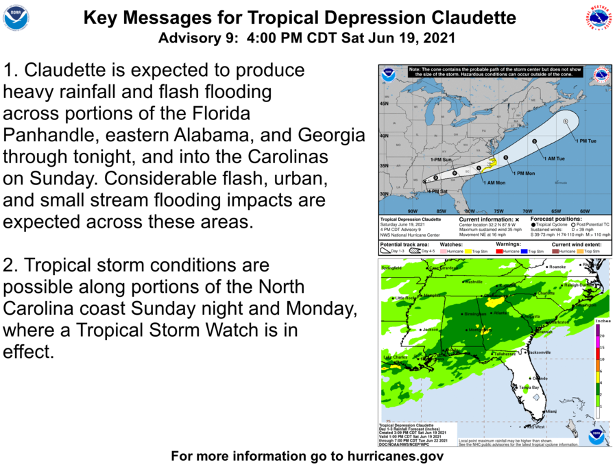
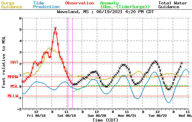
6-19-2021 Pascagoula, Ms Tropical Storm Claudette Storm surge, flooding, power flashes
6-19-2021 Mobile, Al Tropical Storm Claudette- Storm Surge shuts down Causeway- Drone
Claudette has spawned some tornadoes..
Claudette is forecast to remain at about Tropical Depression strength til it emerges on the Carolina coast and possibly strengthens to a Tropical Storm again.
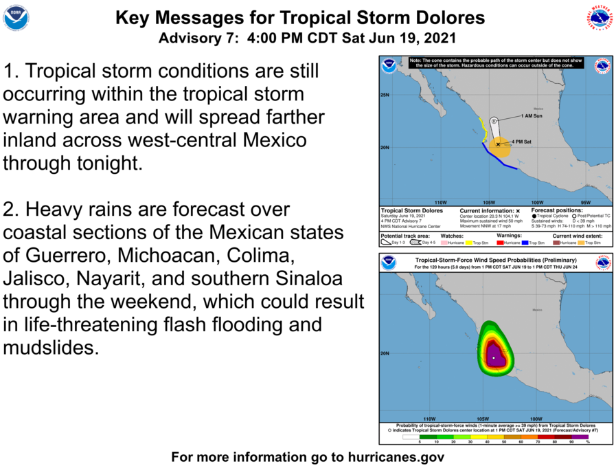
94E is now Dolores
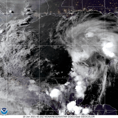
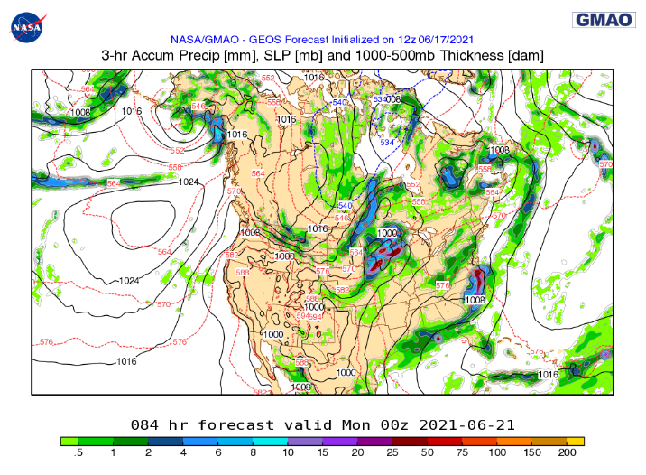
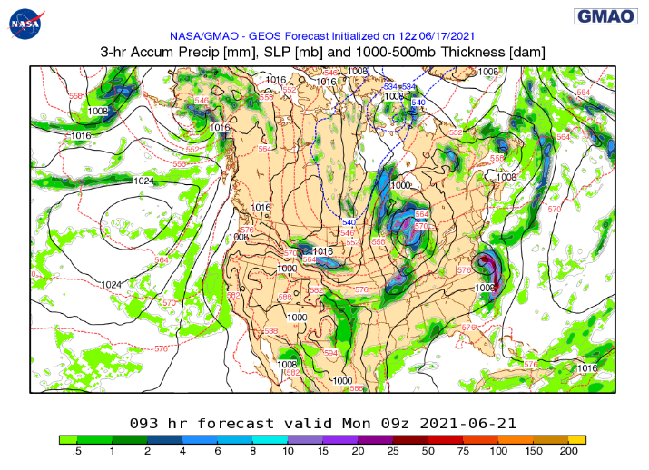
What will most likely become Claudette is expected to make a lopsided landfall and have a wet trip across the Southeast. It may very well be spent with the surface low opening up before making it's way to the warm waters of the Atlantic. GEOS shows another bit of disturbance coming across the country getting swept up in it as it goes to sea and spins back up into a Sub-tropical and then Tropical Storm. A sort of Bill repeat, quick lived and out to sea. If this plays out then the storm maybe renamed Danny.
Santa, El Salvador Flooding in the Central American Gyre Caught between Potential Tropical Depression 3 and 94E. New Crop of Tropical Invests As many times happens after a long stretch of no tropical activity, several invests have been declared. Two are in the East Pacific. 92E is the farther west of the two. 93E is nearly centered on Central America. In the West Pacific there is 92W and 93W. Both are fairly unorganized with 92W currently looking the healthier of the two. 94B is a large gathering of moisture over the Bay of Bengal. 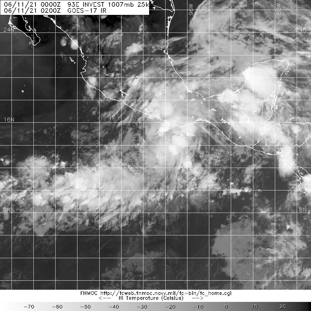 Above 93E is showing the best spin of the invests while 92W has the best convection. Huge Wave Inundated Houses and Coastal Areas After Storm in Valparaiso, Chile Vulnerability
Natural disaster 9 June 2021. Huge waves flood houses and coastal areas after storm in Valparaíso, Chile NASA's 00z GEOS model had the rain off Texas coming together as it came on shore today. Has this pulsing daily with the gulf moisture, at times severe as it moves north and then over the Great Lakes. Comes off that looking more like a Tropical Depression. Exits thru Canada and Maine. Here it is coming in Corpus Christi earlier today. "Massive Tornado Hit Corpus Christi, Texas [ 03.06.2021 ] Corpus Christi Tornado Warning". NWS has several flooding reports in this area. Flooding is ongoing with several Flood Warnings, some Flash Flooding is occurring as well as a Severe Thunderstorm Warning. A large area of Texas is under a Flood Watch. More in depth info is at the NWS Corpus Christi office. There it is forecast after the Great Lakes.. 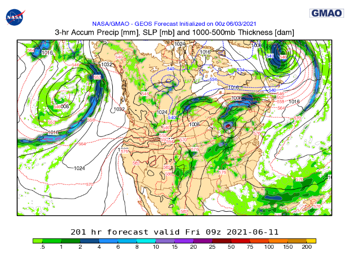 |
Current Tropics and Weather News..
Archives
January 2022
|
 RSS Feed
